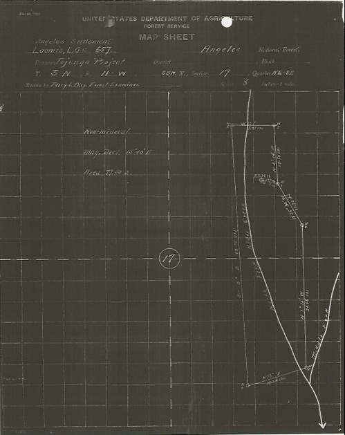
Initial Land Survey
The land survey map below is not dated, but was attached to a set of field notes describing measurements taken on June 6, 1913, by Percy L. Day, Forest Examiner. The map and his field notes established the boundaries of the Loomis Ranch as surveyed by Mr. Day.
[Source: Land Entry File 687185]